
Welcome to our in-depth exploration of two widely used technologies that have revolutionized how we perceive our world from above: aerial imagery and satellite imagery. While these two terms may often be used interchangeably in casual conversation, there are crucial differences that distinctly separate them from one another.
Aerial imagery, derived from cameras mounted on aircrafts, drones, or even balloons, provides us with detailed perspectives from the skies. Satellite imagery, on the other hand, is procured from devices orbiting our Earth, giving us a more comprehensive, global view. Each type has its unique applications, advantages, and limitations, and is used extensively across various industries such as geology, agriculture, meteorology, and urban planning, among others.
In this blog post, we aim to delve deeper into these differences, providing you with a comprehensive understanding that can help you make an informed decision about which type of imagery best suits your needs. So, let’s dive in and explore the fascinating world of aerial and satellite imagery covers, and satellite imagery.
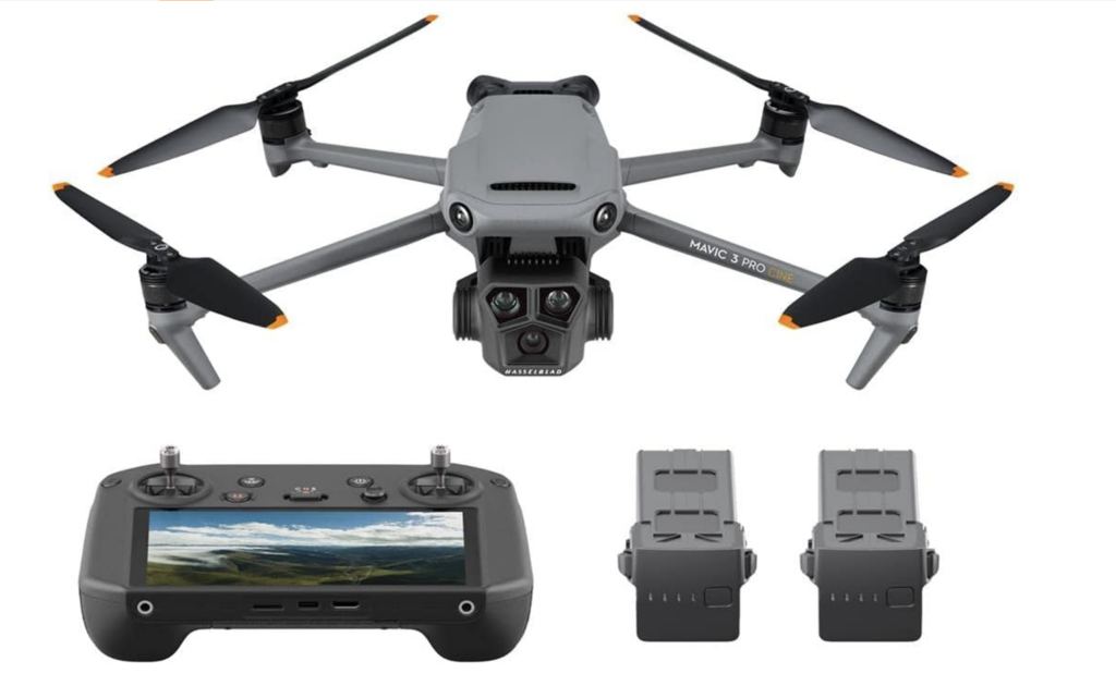
The Drone I Use
Mavic 3 Pro: https://amzn.to/3Bdk6mc
Aerial Imagery

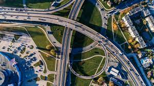
Let’s start our journey by comprehending what aerial imagery really entails. In the simplest of terms, aerial imagery refers to photographs or digital images captured from an elevated or direct-down position. These images are usually taken from an airborne vehicle such as a manned or unmanned aircraft or a satellite.
However, it’s important to note that aerial photographs specifically refers to those images taken from aircraft flying within the Earth’s atmosphere. These images provide a unique bird’s-eye view of the Earth’s surface and are known for their superior resolution and detail compared to satellite images.
Applications of Aerial Imagery

Aerial imagery plays a pivotal role in various sectors, leveraging the high-resolution, detailed images it provides. These images offer a unique aerial perspective, revealing patterns and features that can be difficult to identify from ground level. From making comprehensive maps to monitoring environmental changes and assisting in real estate developments, aerial imagery is at the forefront of numerous industries.
1. Surveying and Mapping:
Surveying and mapping are among the primary applications of aerial imagery. These high-resolution images are instrumental in creating detailed and precise maps of both urban and rural areas. In urban areas digital aerial cameras are used for town planning, infrastructure development, and transport planning. In rural settings, aerial images and satellite maps can aid in outlining property boundaries, agricultural planning, and rural development. The 3D models produced from aerial imagery provide invaluable tools for geologists, architects, and civil engineers alike.
2. Environmental Studies:
Aerial imagery also plays a critical role in environmental studies. It provides essential data for tracking and monitoring changes in ecosystems, deforestation rates, and the impacts of climate change. These images also help in assessing the health of agricultural lands, managing water resources, and conserving wildlife habitats. High-resolution aerial images can reveal details like vegetation health, soil erosion, and other environmental factors, contributing significantly to conservation efforts.
3. Real Estate and Development:
In the realm of real estate and development, aerial imagery has become a game-changer. From capturing panoramic views of properties to assisting in site planning, aerial photos provide comprehensive visuals that can enhance marketing efforts and inform development decisions. In addition, aerial imagery is used to monitor construction progress, inspect infrastructure, and manage property effectively. It not only offers an elevated view of the property in question but also the surrounding environment, critical for development planning and landscape design.
4. Disaster Assessment and Management:
In the field of disaster assessment and management, aerial imagery has emerged as an indispensable tool. These images play a critical role in predicting, preparing for, responding to, and recovering from natural and man-made disasters. From monitoring volcanic activity and tracking the progression of wildfires to mapping flood-prone areas and assessing damage post-disaster, aerial imagery provides valuable data in real-time or near-real-time, facilitating swift and effective disaster management. It aids in planning evacuation routes, deploying resources efficiently, and assisting rescue operations, thereby saving lives and minimizing damage.
Advantages and Limitations of Aerial Imagery
Like any technology, aerial imagery comes with its own set of advantages and limitations.
Advantages:
High-resolution imagery:Aerial images offer a high level of detail as they can be captured from lower altitudes than satellites. This is especially useful for applications that require detailed inspection, such as infrastructure assessment or real estate photography.
Flexible scheduling: Unlike satellites, which have fixed orbits and capture schedules, aerial image capture can be planned according to specific needs, making it highly flexible.
Rapid data acquisition: In situations that demand quick turnaround, such as disaster response, drones can capture and deliver images in a matter of hours.
Limitations:
Limited coverage: While drones and aircraft can capture highly detailed images, they cover a smaller area compared to satellites. This makes aerial imagery less suited for large-scale environmental monitoring or geographical studies.
Weather-dependent: Aerial image capture is heavily dependent on weather conditions. Poor weather can delay flights and affect image quality.
Operational and logistical challenges: Aerial imaging operations require flight permissions, trained pilots (for manned flights), and well-maintained aircraft. These requirements pose operational and logistical challenges, especially in remote or conflict-prone regions.
Understanding these advantages and limitations is crucial in selecting the right imaging technology for a given application.
Satellite Imagery
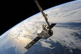
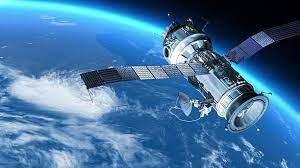
Switching our lens from the atmosphere to space, let’s delve more detail into the world of satellite imagery. Satellite imagery refers to images of the Earth or other planets collected by imaging satellites orbiting the planet in space. Unlike aerial images, satellite images offer a more comprehensive, wide-scale view of the Earth’s surface, making them particularly useful for large-scale studies of the Earth’s systems.
Applications of Satellite Imagery
The wide-scale, comprehensive view provided by satellite imagery opens doors to a range of applications, some of which are impossible with other forms of imaging. Let’s take a look at a few of these commercial applications:
1. Weather Forecasting and Climate Studies:
Satellite imagery plays an integral role in weather forecasting and climate studies. It helps meteorologists track weather systems, predict weather conditions, and identify patterns over time. Satellites are also used for climate studies, including monitoring ice caps, tracking sea-level rise, and measuring variables like temperature, humidity, and aerosols in the Earth’s atmosphere.
2. Remote Sensing in Agriculture:
In agriculture, satellite can collect images that are used for remote sensing to monitor crop health, yield estimation, and soil mapping. These images can show variations in vegetation health, allowing farmers to identify disease or stress in crops early and take necessary actions.
3. Geology and Land Use:
Satellite imagery is also fundamental in geology and land use studies. It helps in identifying geological features, mapping and monitoring land use changes, and assessing the impacts of human activity on the environment. In addition, satellite images are used in the exploration of natural resources, like minerals and oil.
4. Military and Intelligence Purposes:
In the military sector, satellite imagery is used for reconnaissance, surveillance, and gathering intelligence. These images help in tracking movements, assessing threats, and planning military operations.
Advantages and Limitations of Satellite Imagery
Similar to aerial imagery, satellite imagery also has its advantages and limitations, which must be considered when deciding on the appropriate technology for a specific application.
Advantages:
Large-scale coverage: Satellite images can cover vast areas – even entire continents – in a single image. This makes them ideal for large-scale environmental monitoring and geographical studies.
Repetitive coverage: Satellites orbit the Earth regularly, capturing images of the same area multiple times. This allows for tracking changes over time, which is critical in climate studies and land use monitoring.
Availability and accessibility: Satellite images are often more accessible than aerial images, especially for remote or inaccessible regions. Some satellite data, like that from the Landsat program, is freely available to the public.
Limitations:
Lower spatial resolution: Due to their high altitude, satellite images generally have lower resolution compared to aerial images. While this is suitable for large-scale studies, it may not provide the level of detail needed for more localized projects.
Dependent on satellite orbits: The timing and frequency of image capture are dependent on the satellite’s orbit. This means that real-time or on-demand images are not always possible.
Influence of atmospheric conditions: The quality of satellite images can be affected by atmospheric conditions such as clouds and aerosols. While some technologies can minimize this impact, it remains a challenge in satellite imaging.
Understanding these advantages and limitations of satellite pictures can guide users to select the best form of imaging for their specific needs. Whether it’s the high-detail view provided by aerial imagery or the broad-scale perspective offered by satellite imagery, both forms have unique applications and potential.
Comparing Aerial and Satellite Imagery
Now that we have individually understood aerial and satellite imagery, their methodologies, applications, advantages, and limitations, it’s time to draw a comparison between the two. Both forms of imaging offer unique capabilities and challenges, and understanding these differences can help users make an informed decision about which technology is best suited to their needs.
A. Comparisons in terms of Image Resolution
One of the most noticeable differences between aerial and satellite imagery lies in the resolution of the images produced. Aerial images, being captured from a lower altitude, typically offer a higher resolution than satellite images. They can capture extremely detailed and precise images, making them ideal for tasks that require high detail, such as infrastructure inspections, real estate photography, and small-scale mapping. On the other hand, satellite images, though generally lower in resolution than aerial photograph due to their higher altitude, provide a broader view that is essential for large-scale environmental monitoring and geographical studies.
B. Comparisons in terms of Coverage Area
In terms of coverage area, satellite imagery has the upper hand. A single satellite image can cover vast swaths of the Earth’s surface, even entire continents. This makes satellite images particularly suitable for large-scale mapping, climate studies, and monitoring environmental changes over time. On the contrary, aerial imagery, whether taken from a drone or a manned aircraft, covers a much smaller area. However, this restricted coverage allows for much more detailed and focused imagery.
C. Comparisons in terms of Cost
The cost of acquiring imagery can vary significantly between aerial and satellite methods. Satellite imagery can be costly, especially for high-resolution data and specific capture times. On the other hand, aerial imagery, particularly when captured by drones, can be a cost-effective alternative for smaller-scale, localized projects. However, it’s important to consider that operational costs for aerial imaging, such as flight permissions and pilot training, can also add up.
D. Comparisons in terms of Data Collection Frequency
When it comes to data collection frequency, satellites have a clear advantage. Satellites orbit the Earth regularly, capturing images of the same area multiple times, which is crucial for monitoring changes over time. Aerial imagery, on the other hand, can be captured more flexibly, scheduled according to specific needs, and deliver rapid data in situations like disaster response.
E. Comparisons in terms of Operational Complexity
Lastly, the operational complexity of both methods is another crucial factor to consider. Satellite imaging, once set up, provides a consistent stream of data with global coverage. However, their deployment, maintenance, and data retrieval are complex tasks requiring high-tech infrastructure. Meanwhile, aerial imaging requires obtaining flight permissions, trained pilots (for manned flights), maintaining aircraft, and can be affected more significantly by weather conditions.
Use Cases
The selection between aerial and satellite imagery is primarily driven by the specific requirements of a use case. Here are some instances where one might be preferred over the other:
A. Instances where Aerial Imagery is Preferred

Infrastructure Inspection: For detailed inspections of infrastructure, like bridges, power lines, or buildings, aerial imagery, especially from drones, is preferred due to the high-resolution images it can provide.
Real Estate Photography: Aerial imagery is commonly used in real estate to capture detailed and attractive photos of properties.
Disaster Response: In situations that require quick turnaround, like disaster response, drones can capture and deliver images rapidly.
B. Instances where Satellite Imagery is Preferred
Climate Studies: For studying climate change and its impacts over large areas, satellite imagery’s wide-scale coverage is vital.
Large-Scale Agriculture: In agriculture, satellite imagery is beneficial for monitoring crop health and yields over large farms.
Military Surveillance: For global-scale reconnaissance and surveillance, satellite imagery is preferred due to its consistent coverage and remote sensing capabilities.
Conclusion
Exploring the expansive domains of aerial photography and satellite imagery has unveiled their unique attributes and applications. Satellite imagery’s significant contributions to large-scale monitoring and studies are undeniable. However, its practicality and cost-efficiency for average consumers may not measure up to that of aerial photography.
Aerial imagery, particularly drone photography, provides a cost-effective, flexible solution for many needs. Whether it’s real estate marketing, commercial property inspection, or creative projects such images above, aerial images offer detailed views and diverse angles. Paired with music and video footage, these images can be transformed into compelling multimedia content.
JR Resolutions is at your service to harness the power of aerial imaging. Our expertise guarantees top-quality imagery to enrich your business’s visual communication. Despite the in-depth exploration of aerial and satellite imagery in this discussion, remember that the best choice always aligns with your specific needs, goals, and resources. Equipped with this knowledge, you’re now ready to make a more informed decision. Visit Our website to learn more about our services and to schedule a consultation.