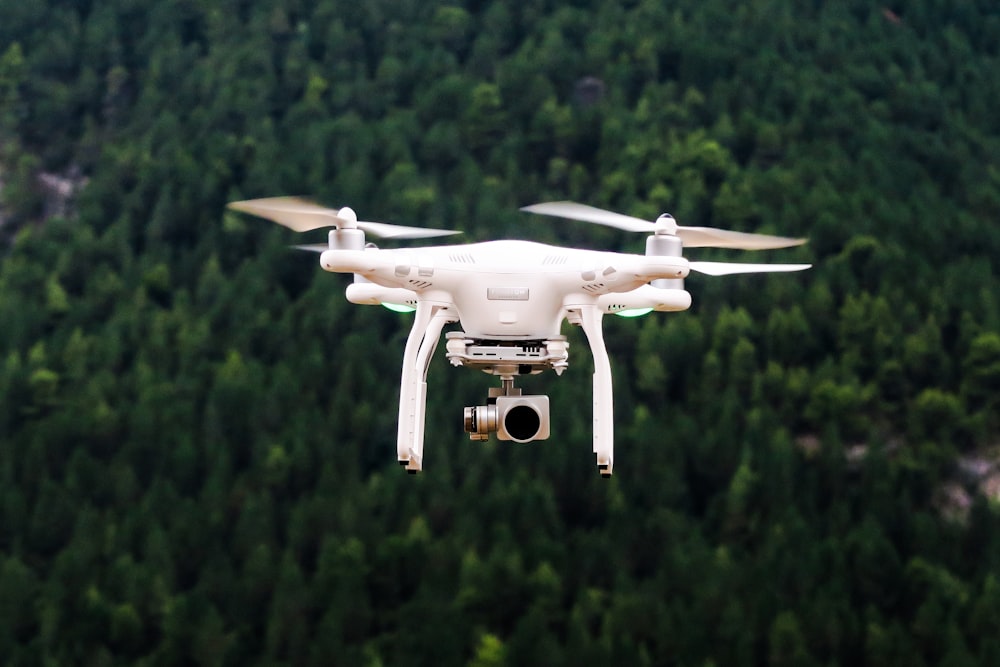
In the pulsating heart of the tech-driven era, the drone, a remote-controlled, unmanned aircraft, is a testament to innovation’s power. With their state-of-the-art capabilities, drones are revolutionizing numerous sectors worldwide. Particularly, the benefits of using drones for commercial real estate have become a significant game-changer, marking a new era in the industry.
Drones, formerly seen as high-tech toys or military tools, are transforming into indispensable assets in the professional world, harnessing the power of aerial shots and data collection to reshape the way we work.
The journey of drones, from their inception to the current day, is a captivating tale of technological evolution. Originating as simple remote-controlled machines for hobbyist enjoyment and military surveillance, drones have evolved into sophisticated tools capable of high-resolution imaging, 3D mapping, data analysis, and much more.
The adoption of drone technology has grown exponentially across numerous sectors, from agriculture and emergency response to media and entertainment. However, drones have truly come into their own within the realms of commercial real estate.
Drones are redefining the landscape of commercial real estate by providing access to perspectives and data previously inaccessible or prohibitively expensive to acquire.
The story of drones in commercial real estate is one of growth, innovation, and immense potential. As the industry continues to embrace these high-flying assistants, the impact is profoundly changing how properties are viewed, evaluated, and marketed.
This narrative explores the breadth and depth of benefits offered by drone technology in the commercial real estate sector. This domain stands on the threshold of a new era powered by the sky’s limitless potential. Join us as we ascend into this exciting realm, where the sky is not the limit but a new beginning.
What is Real Estate Drone Photography?
Real Estate Drone Services encapsulate the broad range of unmanned aerial vehicles (UAV) technology applications, commonly known as drones, in the real estate industry. These services leverage drones’ versatile and advanced capabilities, including high-resolution imaging, accurate geographical mapping, and swift unmanned aerial vehicle mobility, to provide innovative solutions for various aspects of real estate management and transactions.
Leveraging aerial photography in real estate not only piques visual interest in a property but also offers remarkable value for the cost. Data from the Multiple Listing Service (MLS) suggests that properties showcased with aerial images have a 68% higher likelihood of being sold compared to those without such imagery. This trend shows no sign of slowing down, indicating an increasing advantage of aerial photography in real estate sales. Here’s a comprehensive look at these services:
Aerial Photography and Videography:
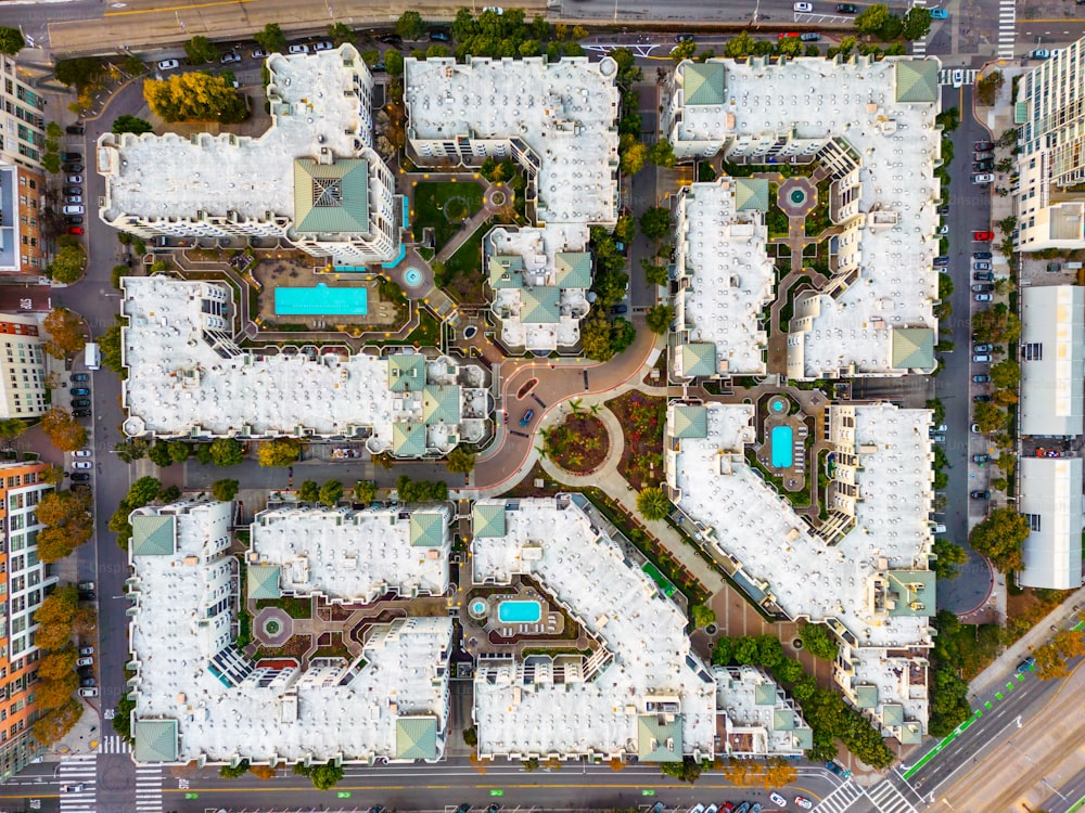
Aerial drone photography and videography have become vital tools for commercial real estate agents. With drones equipped with high-end cameras, agents can capture breathtaking images and videos of properties from diverse perspectives and heights.
Applying real estate drone photography provides a comprehensive perspective of a property. It extends beyond just the structure, offering a sweeping view of the surrounding environment, neighborhood, and distinctive aspects that might remain hidden from a ground-level viewpoint. This is a clear edge over conventional photography, especially when dealing with expansive properties or estates.
Here, capturing the scope or layout’s significant aspects can be challenging from the ground level. Hence, real estate drone photography provides a solution that is both effective and captivating in the real estate market.
3D Mapping and Modelling While Using Drones For Commercial Real Estate
Drones can also create precise 3D maps and models of properties. Using advanced imaging techniques and software, drones capture multiple images from different angles, stitched together to form a comprehensive 3D representation.
This is extremely useful in commercial real estate, where potential investors or buyers can get a detailed understanding of large-scale properties. These 3D models can also be used in marketing materials or virtual tours, providing an interactive experience for potential clients.
Property Inspections:
Another vital service offered by aerial photography is property inspections. Traditionally, inspecting certain parts of a building, such as the roof, high-rise sections, or large structures, could be time-consuming, costly, and potentially hazardous.
Drones, however, can easily access these areas, capturing high-resolution images or videos that can be used for maintenance checks, damage assessments, or insurance documentation. This saves time, reduces risk, and provides more accurate and comprehensive data for property evaluations.
Virtual Tours and Marketing:
In the digital age, virtual tours have become a crucial part of real estate marketing, and drones play a significant role in creating these immersive experiences. Using drone-captured footage, many real estate marketing professionals can create compelling virtual tours that allow potential buyers or tenants to explore properties remotely. This is particularly beneficial today, where social distancing measures and busy schedules may limit in-person property visits.
Construction Progress Monitoring:
Drones are also becoming increasingly prevalent in monitoring the progress of construction projects. Regular drone flights can capture the construction site from various angles, providing clear visual updates on the project’s status. This can help identify potential issues early, ensure compliance with project plans, and keep all stakeholders informed about the project’s progress.
Land Surveying and Analysis:
Drones with specialized sensors can perform in-depth land surveys, gathering data about the property’s topography, soil conditions, vegetation, and other environmental factors. This information can be invaluable for site selection, planning and design, environmental impact assessments, and other pre-construction processes.
Thermal Imaging:
Some drones are equipped with thermal cameras that can detect heat signatures. In real estate, this can be used to assess a building’s energy efficiency, identify heat leaks, or spot hidden problems like water damage or insulation gaps.
Security Surveillance:
For large commercial estates or properties in remote locations, drones can provide efficient and effective security surveillance, ensuring the safety and integrity of the property.
Real estate professionals can integrate drones into their operations to enhance their property listings, evaluations, marketing strategies, construction management, and overall service offerings. As drone technology continues to evolve, so will the scope and market impact of Real Estate Drone Services, opening up new possibilities for innovation and efficiency in the industry.
The Benefits Of Using Drones For Commercial Real Estate

Drones have an incredible range of applications in the commercial real estate process, from the initial land acquisition phase to the final sale or lease. Below, we delve into the many benefits of both real estate photography with drone photography:
Land Acquisition
Land acquisition is the initial and critical phase in any commercial real estate project. It involves identifying, inspecting, assessing, and purchasing a suitable piece of land where the real estate project will be developed. This stage is crucial as it sets the foundation for the project, influencing factors like project cost, design, construction, marketability, and potential return on investment. Here’s how drone technology can play a pivotal role in this stage:
Faster and More Accurate Site Identification:
One of the first steps in the land acquisition process is identifying potential sites for development. Traditional methods require significant time and manual effort, often involving site visits, consultation with local authorities, and extensive paperwork. With the advent of drone imagery technology, this process can be substantially streamlined.
Drones, equipped with high-resolution cameras, can swiftly survey large areas, providing detailed aerial views that reveal site features not easily seen from the ground. This allows commercial realtors and estate agents to identify potential sites more quickly and accurately, saving time and resources.
Improved Environmental Impact Assessments:
Before acquiring a site, it’s crucial to understand its environmental implications, which can affect project feasibility, design considerations, and regulatory compliance. Using drones for commercial real estate can be outfitted with various sensors to collect data on topography, vegetation, water bodies, and other environmental features.
This data can be used to create detailed environmental impact assessments, helping developers understand potential challenges and plan accordingly. For example, a drone pilot might detect a wetland area on a potential site, alerting developers to necessary environmental considerations and potential regulatory issues.
Enhanced Due Diligence with Aerial Mapping and Imaging:
Due diligence is a critical part of land acquisition, involving a comprehensive site review to identify potential issues, such as property disputes, zoning restrictions, or structural problems. Drones can play a crucial role in this process. With aerial mapping and imaging, drones can create high-resolution, 2D, and 3D maps of the site, providing a level of detail and perspective on land areas that traditional survey methods can’t match.
These maps can reveal property boundaries, access points, neighboring properties, and other critical information that can impact the site’s suitability for development. This enhances the due diligence process and reduces the risk of unforeseen issues arising later in the project.
Construction
The construction phase begins once the land has been acquired and the planning is complete. This is where the design and plans become a reality, with teams of contractors and workers collaborating to build the project.
Construction is a complex, resource-intensive phase that requires careful management and coordination. Ensuring timely progress, maintaining quality control, ensuring safety, and keeping all stakeholders informed are key aspects of this stage. Here’s how drones can revolutionize these aspects:
Efficient Construction Site Monitoring:
Construction sites, especially for large commercial real estate projects, can be vast and challenging to monitor manually. Drones can quickly and easily traverse the area, capturing high-resolution still images and videos that comprehensively overview the construction progress.
They can access hard-to-reach areas, such as high-rise sections or tight spaces, and provide detailed visual data that can be used to assess the work done and plan future tasks. This makes construction site monitoring more efficient, accurate, and cost-effective.
Real-Time Project Updates for Stakeholders:
Utilizing real estate drone photography is pivotal in modern construction management. Traditionally, stakeholders stayed informed about a project’s progress through site visits, meetings, and detailed reporting. However, the advent of drone technology has revolutionized these communication methods, providing real-time visual updates directly from the construction site.
Frequent drone flights are employed to record the ongoing status of the project. This drone photography, which provides an aerial perspective that’s both comprehensive and detailed, is then shared with stakeholders to keep them abreast of the project’s developments. This method not only augments communication but also promotes transparency, offering a bird’s eye view of the construction site.
Aerial drone photography in real estate and construction management provides stakeholders with an unparalleled ability to identify and address potential issues promptly. Offering a clear, up-to-date picture of the site’s condition, reduces the risk of miscommunication and misunderstanding, leading to a smoother, more efficient construction process.
Detection of Safety Hazards and Quality Control Issues:
Construction sites can be hazardous, with risks of accidents due to falling objects, machinery malfunctions, or human error. Drones can help mitigate these risks by identifying safety hazards early. They can monitor the site for unsafe practices or conditions, such as improperly stored materials, lack of safety gear, or structural issues.
In addition, drones can also detect quality control issues, like construction defects or deviations from the plan. This allows for early intervention and correction, ensuring the project’s safety and quality standards are maintained.
Building Completion
Upon the culmination of the construction phase, the building completion stage begins. This critical juncture in the commercial real estate process involves a series of inspections to ensure that the newly constructed building complies with the initial plans, local building codes, and safety regulations.
It’s also the phase where final walkthroughs are conducted, any remaining issues are addressed, and the necessary documentation is prepared for the property transfer. Drone technology can be a valuable asset during this stage, providing numerous benefits:
Rapid Inspection of Completed Structures:
Inspecting a newly constructed building, especially a large commercial property, can be time-consuming and challenging. Drones can expedite this process by quickly scanning the entire structure, including hard-to-reach areas like rooftops or high-rise sections.
Equipped with high-resolution cameras, drones can capture detailed images that can be used to assess the quality of the construction, identify any remaining issues, and ensure that the project aligns with the original plans.
Verification of Compliance with Regulations and Codes:
Ensuring that the new building complies with local building codes and safety regulations is critical to the building completion phase. Violations can lead to fines, delays, or even the need for costly modifications.
Drones can assist in this process by providing a comprehensive structure overview, allowing inspectors to verify compliance more easily. For instance, drones can inspect rooftop installations, fire escape routes, or accessibility features to ensure they meet the necessary standards.
Facilitation of Final Walkthroughs and Documentation:
Before a commercial property can be sold or leased, a final walkthrough is usually conducted to document the state of the property and identify any remaining issues that need to be addressed. Drones can facilitate this process by creating high-quality video walkthroughs that capture the property from multiple perspectives.
These drone-captured walkthroughs can provide a more detailed and engaging view of the property than traditional virtual tours. Moreover, the footage aims to create a visual record of the property at completion, which can be useful for future reference or in case of disputes.
Tenant Move-In When Using Drones For Commercial Real Estate
The tenant transition phase, which begins once a property is ready for occupancy, is crucial in property management. This phase entails marketing the property, conducting viewings, finalizing lease agreements, and guiding tenants through the move-in process. A practical tenant transition phase can establish a positive relationship between landlord and tenant. Drones can significantly enhance this process in several ways:
Promoting Property and Local Amenities:
It’s essential to showcase the property and its unique features effectively to attract tenants. Using drones for commercial real estate can provide breathtaking aerial footage, still photos, and videos highlighting the property and its surroundings. This includes the building’s design, layout, amenities, and even the neighboring corporate environment.
With drone footage, a potential buyer or tenants can comprehensively understand the property and its advantages. The footage can also visually represent the property’s proximity to major transport arteries such as I-95, adding to its appeal.
Virtual Tours for Efficient Property Viewing:
Prospective tenants will want to view the property before committing to a lease. Physical tours can be inconvenient and time-consuming, and social distancing protocols may sometimes make them less feasible. Drones offer a solution by facilitating the creation of immersive 3D tours.
High-resolution drone-captured images, photos, and videos can be used to create interactive digital tours. These tours help to access remotely and viewed at the tenant’s convenience. It streamlines the viewing process and allows potential tenants to examine the property in detail, including parking capacity and areas with high traffic counts.
Improved Tenant Communication:
Communication is a pivotal aspect of the tenant transition phase. Tenants frequently have queries about the property, lease agreement, or the move-in process. Here, drones can be a valuable tool in providing visual clarification.
For instance, if a tenant has a question about the location of a specific facility or how to access a particular part of the property, drone footage can provide a clear, visual explanation. This can prevent any potential confusion, ensuring a seamless move-in process. The drone can also highlight the property’s parking capacity and accessibility from nearby roads or highways, an essential factor for many tenants. Overall, using drones in the tenant transition phase can significantly enhance the tenant’s experience and the overall efficiency of the process.
Building Management
Building management is an ongoing stage in the life cycle of commercial real estate, extending from tenant move-in until the end of the property’s use. It involves maintaining the property, ensuring tenant satisfaction, keeping the building safe, and addressing any issues or challenges that arise over time.
This phase is crucial for preserving the property’s value, ensuring a steady income stream, and fostering positive relationships with tenants. Here’s how drones can provide significant business benefits in this phase:
Regular Maintenance Inspections with Minimal Disruptions:
Keeping a commercial property in good condition requires regular maintenance inspections. However, these inspections can be disruptive, particularly in large or occupied properties. Drones can carry out these inspections quickly and without intruding on tenant spaces.
They can easily access areas like rooftops, facades, and other hard-to-reach places, capturing high-resolution images that can be used to assess the property’s condition. This minimizes disruptions and makes the inspection process more efficient and thorough.
Early Detection of Potential Issues for Proactive Solutions:
Real estate drone photography plays an essential role in detecting building issues that could potentially escalate if left unnoticed. Drones offer a detailed perspective of a building’s structure and surroundings, helping to identify problems like structural damage, leaks, or HVAC issues promptly.
For instance, a drone equipped with thermal imaging technology can spot heat leaks or insulation inconsistencies invisible to the naked eye. This advanced use of drone photography not only enhances the scope of real estate inspections but also adds a proactive dimension to building maintenance.
In addition, drones are invaluable in identifying external signs of wear and tear that could hint at deeper structural complications. These high-resolution aerial images, a hallmark of drone photography in real estate, provide a comprehensive view of a property, making it easier to spot potential problems.
By facilitating early detection, drone photography allows for preemptive maintenance measures, curbing minor issues before they balloon into significant concerns.
Increased Security and Surveillance Capabilities
Security is critical to building management, particularly for large commercial properties. Drones can enhance a property’s security by providing aerial surveillance, monitoring the property for unusual activity, and quickly investigating potential security concerns.
They can cover large areas quickly, operate in low-light conditions, and provide real-time video feeds to security personnel. This increases the coverage and effectiveness of security efforts and acts as a deterrent to potential intruders.
Legal and Ethical Considerations of Drone Technology
The utilization of drone technology has surged in recent years, offering immense potential across various industries. However, along with its remarkable capabilities, the widespread use of drones also raises important legal and ethical considerations.
Understanding and addressing these considerations are crucial for responsible and compliant drone operations. Three key aspects deserve significant attention: FAA regulations, privacy concerns, and various liability insurance considerations.
The Federal Aviation Administration (FAA) governs the use of drones in the United States, establishing laws, guidelines, and regulations to ensure safe and responsible drone operation here. These regulations cover registration, pilot certification, flight restrictions, and operational limitations. The FAA’s rules aim to balance enabling the commercial use of drones and maintaining public safety and airspace integrity.
Rise Of Drones
The rise of drones has sparked concerns related to privacy, as these devices can capture high-resolution images and videos from aerial perspectives. Individuals may feel their privacy is compromised if drones are used for surveillance or infringe upon their personal spaces. Addressing these concerns and developing strategies to manage privacy considerations when utilizing drones for real estate is crucial.
This involves respecting private property rights, obtaining necessary permissions for capturing aerial images, and establishing guidelines for drone operations in sensitive areas. Transparency, communication, and adherence to existing privacy laws are vital to ensuring responsible drone use while protecting individual privacy.
Insurance considerations are essential to drone operations, as accidents or incidents involving drones can result in property damage, personal injury, or legal liability. Operators should explore drone-specific insurance policies to protect themselves and mitigate potential risks adequately.
Insurance coverage for drones typically includes liability coverage for property damage or bodily injury and hull coverage for physical damage to the drone itself. Understanding the specific requirements of drone insurance, including coverage limits, exclusions, and deductibles, is crucial for responsible drone operations.
It is worth noting that regulations, privacy concerns, and insurance considerations allowing drones may vary across jurisdictions. Drone operators should stay up-to-date with local laws and regulations and consult legal professionals or industry experts to ensure compliance and ethical use of drone technology.
By proactively addressing legal and ethical considerations, drone operators can navigate the evolving landscape responsibly, mitigate risks, and contribute to the positive integration of drones in various sectors.
Conclusion
The benefits of using drones for commercial real estate are proving to be multifaceted, with the potential to reshape the entire industry. From accelerating the land acquisition process to enhancing construction, marketing, and building management, drones have proven invaluable tools.
By leveraging drones for real estate, professionals in commercial real estate can gain a competitive edge. They can access aerial views that reveal the full potential of properties, create immersive virtual tours that attract potential buyers or tenants, and conduct efficient inspections that improve maintenance and ensure regulatory compliance. Drones streamline processes, save time and resources, and offer enhanced insights that were once difficult to obtain.
To fully harness the benefits of real estate drone photography, professional needs to collaborate with experts who specialize in drone services. Our team navigates the legal and ethical considerations of real estate companies’ drone use, ensuring compliance and responsible operations.
Whether you are a developer, investor, property manager, or real estate agent, partnering with JR Resolutions can unlock the immense potential of drones for commercial real estate endeavors. We offer various services, including aerial photography, 3D mapping, aerial imagery, drone photography, property inspections, and virtual tours.
Embrace the future of commercial and residential real estate by incorporating drone technology into your operations. However, if you’re unsure about how to hire a qualified drone pilot, here’s what you need to know. Read our comprehensive blog post on ‘How to Hire a Qualified Drone Pilot’ for an in-depth guide on what to look for when bringing a drone pilot on board. Contact Us today to explore how our cutting-edge drone solutions can elevate your projects, enhance decision-making, and drive success in the dynamic and competitive real estate landscape.