

From the breathtaking bird’s-eye views of sprawling cities to the majestic scenes of natural wonders, aerial photos and videos have transformed the way we perceive our world. In yesteryears, such views were only accessible to pilots and astronauts or people used hot air balloon for taking such pictures. But with technological advancements, these mesmerizing visuals have become part of our daily lives, gracing our screens, magazines, and galleries. Aerial photography and videography not only offer unparalleled perspectives, but they also play pivotal roles in various sectors—from urban planning to cinematic productions.
This article delves deep into the art and science behind capturing these awe-inspiring images and videos from the skies. Whether you’re a professional looking to refine your vertical photography skills, an enthusiast seeking knowledge, or simply a curious soul, join us as we unravel the mysteries behind the lens, high above the ground. Welcome to the captivating world of aerial photography and videography.
Types of Aerial Photography & Videography
As the sky opens up a limitless canvas, aerial imagery and videography have evolved into distinct styles and techniques, each offering a unique perspective and purpose. These visual formats not only serve different storytelling needs but also technical applications in various industries.
Before diving into the realm of drones or climbing into the cockpit of a helicopter, understanding these fundamental types is essential for both amateurs and professionals alike.
Oblique vs. Vertical Shots
Oblique Shots: These are taken at an angle, often offering a more dynamic and natural aerial view, similar to how we perceive landscapes from a high point or an airplane window. Moreover, Oblique shots can be further divided into low oblique (where the horizon isn’t visible) and high oblique (where the horizon is part of the composition).
Vertical Shots: As the name suggests, these images are captured directly from above, looking down vertically. Low altitude aerial photography is particularly useful for mapping, planning, and certain research purposes. They provide aerial view on a consistent scale, making measurements and evaluations more precise.
Panoramic and Wide-Angle Shots
Panoramic Shots: These shots capture a wide horizontal field of view, often covering landscapes in their entirety. They can stitch together multiple images to offer a broad, all-encompassing perspective, ideal for showcasing vast landscapes or city skylines.
Wide-Angle Shots: Using wide-angle lenses, these shots capture a more expansive view in a single frame, compared to standard lenses. They’re particularly effective in portraying the grandeur of a location, introducing a slight distortion that can add a dramatic touch to the visuals.
Equipment Used
Venturing into the skies to capture that perfect shot isn’t just about the skill of the photographer, but also the tools at their disposal. The evolution of equipment in aerial photography and videography has been nothing short of revolutionary, offering greater accessibility, flexibility, and precision with every technological leap. From roaring engines of aircrafts to the silent hum of drones, let’s soar through the various equipment that has enabled artists and professionals to bring the world from above to our screens and prints.
Overview of Traditional Aircraft (Planes & Helicopters)
Planes: Historically, fixed-wing aircraft were the primary means to obtain aerial photographs, especially for large-scale surveys and reconnaissance. They offer stability, can cover vast distances, and carry heavy, high-resolution cameras.
Helicopters: These provide a unique advantage with their ability to hover, making them perfect for capturing specific points of interest, dynamic events, or rapidly changing scenes. Their maneuverability allows photographers to achieve specific angles and compositions.
Drones: The Game-Changer
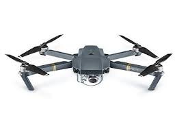
In the recent past, drones have democratized aerial photography and videography. No longer are aerial shots restricted to high-budget productions or specialized surveys. With their ease of use, affordability, and portability, drones have revolutionized the way we capture aerial photograph, and perceive our surroundings from above.
Different Types of Drones
Consumer Drones: Designed for enthusiasts and hobbyists, these are typically lightweight, user-friendly, and come equipped with decent camera systems for everyday shooting.
Professional Drones: These are built for serious photographers, filmmakers, and aerial survey lessors. They often support interchangeable lens systems, have higher resolution cameras, and offer advanced flight and safety features.
Specialized Drones: Built for specific tasks such as agricultural surveys wartime aerial images, thermal imaging, or 3D mapping, these drones are equipped with specialized sensors and cameras tailored to their purpose.
Camera Specifications for Aerial Shots
Resolution: Essential for clarity, especially when cropping or zooming into specific details.
Sensor Size: Determines the quality of the image, especially in varied lighting conditions.
Lens Flexibility: The ability to change lenses can offer varied focal lengths and perspectives.
Stabilization: Crucial for clear and sharp images, especially given the movement during flights. Most aerial cameras are equipped with gimbal systems to counteract the vibrations and sudden movements light aircraft.
Techniques in Capturing Aerial Shots
Ascending to the skies offers a plethora of opportunities, but capturing that sublime aerial shot is more than just pressing a button from a height. Mastery in unmanned aerial photography, imagery and videography hinges on various factors – some controlled by nature, others by the photographer. Let’s explore the key techniques and considerations that ensure each flight yields captivating results.
Planning and Scouting
Pre-flight Planning: Before taking off, a thorough understanding of the location, objectives, and possible challenges is vital. Using maps, satellite images, video cameras, or ground-level reconnaissance can provide valuable insights.
Virtual Scouting: With advancements in technology, various apps and software allow virtual scouting, helping to visualize shots before the actual flight.
Weather Considerations
Wind: Strong winds can not only make flight difficult but can also cause camera shake, affecting image clarity. It’s essential to monitor wind speeds and directions.
Cloud Cover: While overcast conditions might provide soft lighting, they can also obscure specific scenes or create flat images lacking depth. On the other hand, a partly cloudy day can cast dramatic shadows, adding depth and texture.
Rain and Snow: Precipitation can offer unique photographic opportunities but also come with challenges, from protecting the equipment to achieving clear shots amidst falling droplets or flakes.
Time of Day and Lighting Conditions
Golden Hours: The time just after sunrise and before sunset offers soft, golden lighting, reducing harsh shadows and producing warm tones.
Midday Sun: While the overhead sun can cause strong shadows, especially in vertical shots, it can also bring out vivid colors and details in specific landscapes.
Diffused Lighting: Cloudy days or mist can provide diffused light, ideal for capturing details without stark shadows.
Flight Patterns and Maneuvers
Orbiting: Circling around a point of interest can give varied perspectives and dynamic footage, especially for videography.
Elevation Changes: Moving vertically can offer both broad, sweeping views and detailed close-ups.
Tilt and Pan: These are essential maneuvers for videographers, enabling smooth transitions and varied compositions without changing the drone’s position.
Camera Settings for Optimal Shots
Shutter Speed: In aerial photography, a faster shutter speed often helps in minimizing motion blur, especially if the aircraft or drone is moving swiftly.
Aperture: Depending on the depth of field desired, adjusting the aperture can help in focusing on specific elements or providing a sharp view of the entire landscape.
ISO: Balancing ISO is crucial, especially in changing light conditions. While higher ISO values can help in low light, they might introduce noise.
White Balance: Ensuring accurate color representation is essential, and adjusting the white balance according to the lighting conditions can make a significant difference.
Crafting that perfect aerial shot requires a symphony of the right conditions, equipment, and skills. With patience, practice, and these techniques in your arsenal, the sky is not the limit but your canvas.
Post-Production: Enhancing Aerial Shots
After the exhilaration of a successful flight and the anticipation of viewing captured aerial images afterwards, the journey of an aerial shot is far from over. Post-production is where raw captures are transformed into mesmerizing masterpieces. It’s in this phase that imperfections can be corrected, and the artist’s vision fully realized. Let’s dive into the techniques and tools that can elevate aerial shots to their fullest potential.
Image Stabilization Techniques
Software Stabilization: Many modern editing software have stabilization tools that analyze the footage, correct minor shakes, and ensure smooth pans.
Warp Stabilizer: Specifically designed for video footage, tools like the Warp Stabilizer in Adobe Premiere Pro can dynamically stabilize shaky shots, rendering them smooth.
Gimbal Calibration: While technically a pre-production step, ensuring that your gimbal is calibrated can reduce the need for excessive stabilization in post-production.
Color Correction and Grading
Correction vs. Grading: While color correction ensures accuracy and balance, color grading infuses a mood or tone to the imagery. Both are vital for achieving a desired aesthetic.
Adjusting White Balance: Ensuring the whites are true to form is the first step in color correction. Tools allow for tweaking temperature (blue to yellow) and tint (green to magenta) to get accurate colors.
Using LUTs: Look-Up Tables (LUTs) provide preset color grading effects, offering a starting point or even a final touch to the aerial footage. They can be tweaked further to fit the desired look.
Adjusting Highlights and Shadows: This ensures that the image has depth and dimension. Curves and levels can be used to fine-tune the contrast and brightness.
Editing Tools and Software Recommendations
Adobe Lightroom and Photoshop: Ideal for photo editing, they offer extensive tools for color correction, cropping, retouching, and more.
Adobe Premiere Pro and After Effects: Catered more towards videographers, these tools are robust for video editing, effects, and stabilization.
DaVinci Resolve: Known for its powerful color grading tools, it’s a comprehensive software for video editing and post-production tasks.
Final Cut Pro: Exclusive to Apple, it offers a seamless video editing experience with a plethora of in-built tools and effects.
Skylum Luminar: Especially useful for aerial photos, it offers AI-enhanced tools that can automatically enhance landscapes, skies, and other elements.
Challenges in Aerial Photography & Videography
Aerial photography and videography, while offering unparalleled perspectives and captivating visuals, come with their own set of challenges. These challenges test the mettle of the photographer, the endurance of the equipment, and the adaptability of both to ever-changing conditions. Understanding these hurdles is the first step in overcoming them, ensuring that each flight culminates in successful imagery.
Environmental Challenges
Wind: Even a slight breeze can make stabilizing a shot difficult, especially at higher altitudes. Wind can cause unexpected movements, camera shake, and even pose risks to the safety of the drone or aircraft.
Birds and Wildlife: Birds can perceive drones and other flying equipment as threats, leading to potential collisions. It’s crucial to be aware of bird paths, nesting areas, and migratory patterns.
Precipitation: Rain, snow, and mist can not only obscure the lens but also pose risks to electronic equipment. Furthermore, moisture can affect flight dynamics and visibility.
Temperature: Extreme cold or heat can impact battery performance, equipment stability, and even the physical well-being of the pilot.
Technological Challenges
Battery Life: Most drones have a limited flight time, often ranging from 20 to 30 minutes. This constraint demands efficient planning to ensure all desired shots are captured before the battery runs out.
Signal Interference: In urban areas or places with strong electromagnetic fields, signal interference can lead to loss of control, disrupted feeds, or even drone malfunctions.
Equipment Malfunctions: From gimbal issues to lens malfunctions, technical glitches can occur, hampering the shooting process.
GPS Reliability: For precise positioning and safe flights, a strong GPS signal is crucial. In some areas, obtaining a reliable signal can be challenging.
Skill-based Challenges
Piloting: Maneuvering a drone or aircraft, especially in challenging conditions, requires skill and experience. Misjudgments can lead to crashes, missed shots, or safety hazards.
Framing Shots: Achieving the desired composition from the air is different than ground-level landscape photography. Understanding angles, distances, and perspectives from a height demands a refined skill set.
Understanding Equipment: Each drone or camera has its unique features, strengths, and limitations. Mastery over equipment ensures optimal results and reduces the risk of mishaps.
Real-time Decisions: Changing light, unexpected obstacles, or sudden weather shifts require immediate decisions. Adapting on-the-fly is a challenge every aerial photographer and videographer must be prepared for.
Conclusion
As you can see, there’s a lot that goes into aerial photography and when it is produced by an experienced professional it can be a tremendous asset to any business. The right set of aerial photos or a perfectly shot aerial video can give your customers a whole new perspective on what your business has to offer…quite literally. It’s a marketing tool that can’t possibly be underestimated and it’s what makes JR Resolutions stand out from the pack.
We put our equipment and expertise to use getting high quality aerial photographs or video footage of your building, property or yacht. These images can then be incorporated into your overall marketing plan to enhance your website and highlight what you have to offer. We genuinely love what we do and we use this exciting technology to help bring your business to life in ways you’ve never imagined.